Read an in-depth review by Morley Elridge at SISKA, a non-profit dedicated to sea kayaking on Vancouver Island. All texts are excerpts from this original article.
Figure 1. MAPTATTOO on the spray skirt.
I have wanted for a long time to write a proper review of this new small-boat navigation device. MAPTATTOO may be assembled in Chicago (Please! Keep reading!), but it was born on the BC Coast, during the inventor/adventure racer/manufacturer/entrepreneur Erwan Kerebel’s rowing/sailing Race to Alaska. He used a phone running Navionics to go from Port Townsend to Ketchikan. He got there in the end, but on the way had a life lesson in the shortcomings of using a phone to navigate. Short battery life with painful and frequent recharging; hard to see in sunlight or in the dark; hard to read from more than elbow length away; and trying to pinch and scroll and select on a touch screen with cold wet hands and flying spray… MAPTATTOO fixes all that.
With MAPTATTOO, you can read the names of water bodies and landforms on the screen (Figure 1). Easily. And, compared to similar-priced high end handheld GPS running Garmin software, when you use the search function to find a water body or point name, MAPTATTOO f inds it and can pan there then select a point as a destination for electronic navigation; the Garmin in contrast defaults to commercial locations and often finds the nearest marina or restaurant with a similar name in Oklahoma or the Bahamas, but the cove 5 nautical miles away isn’t on the list.
MAPTATTOO has a 50-hour battery life. I’ve run mine over several days paddling to a cumulative 45 hours of use and it still showed 10% battery left, so I believe that number. Changing batteries or recharging is not so important when day paddling, but on a longer trip it becomes a chore and a likely ingress of salt water if you have to change batteries in conditions. The MAPTATTOO is waterproof but doesn’t float. I have mine on a lanyard clipped to a perimeter line. Some people mount them in a holder forward of the cockpit. Mine has been washed loose in surf launches twice and its swum a couple of other times when I was ham-fisted or didn’t tuck it under a line before hard edging, or was just stupid (but not so stupid as to not fasten it to a lanyard and clip!)
It’s well-sealed. You can use it with the touchscreen – but when the sleet hits the fan, it has almost all functions available with physical push buttons. You can use your wet frozen figures to push pan buttons up down right left or press the centre ‘tophat’ button to pan to your current location. You can use other buttons to zoom in or out or to bring up the options screens. It has BIG display numbers for speed and heading.
Figure 2. The basic speed and heading display and custom navigation bar
Those numbers are over a ½ inch or 15 mm tall (Figure 2). They could be read a whole boat length away. The screen is 6 inches or 15 cm in diagonal, so there is also room for a secondary display under the top. Depending on what you want to show and whether you are actively navigating to a waypoint or along a route, this secondary display can include 4 additional pieces of information, which can be customized. In the example below, a waypoint “Albert Head” (the display is much clearer than this cropped GoPro photo, so the waypoint name more legible than it appears) is 0.48 nautical miles away. It shows a speed-made-good of 4.1 knots (I’m paddling almost exactly to the waypoint so this would be slower if I was having to go at an angle, for instance around an obstruction). The bearing to next waypoint is 125 degrees, and I need to turn 1 degree to the right to the direction right or left to turn and the amount to turn to be on track to the waypoint. One degree is close enough. A bunch of other options such as clock time anticipated on reaching the waypoint can be substituted for any of these numbers, or you can pick from several preselected groups to show.
Figure 3. Part of the display showing Albert Head and Royal Roads anchorage in moderate detail with a scale and north arrow at the bottom. The display orientation can be changed to heading up instead of north up.
There is a north arrow and scale at the bottom. Those two overlay the chart so they don’t really take up any room (Figure 3). Most of the real estate is for chart display. The charts themselves are in a custom format that is unique to the MAPTATTOO. Its clear and uncluttered. You can touch the screen to get further information about Nav aids, or tide or current stations, or symbols on the chart you are unfamiliar with. The screen is grey scale and easy to read in any light or at night. Everything is maximized for long battery life, with options that use only a tiny bit more power to show you more bells and whistles.
One set of nautical charts is included with purchase. I naturally chose the Canadian west coast. The US west coast or the US or Canadian east coast and a few other areas are also available and each set only costs another $40. That is a bargain compared to the competition. MAPTATTOO automatically displays the most relevant, detailed chart available for your area. As you zoom in, it will show a more detailed large-scale chart if available; and zooming out shows a smaller scale, with less detail. The chart detail also changes depending on zoom, but it works very, very well. The font sizes for labelling can also be changed. So if, you need to read those depth soundings, you might not even need the reading glasses. The chart below (Figure 4) zooms in close to the little slot channel we paddle through at Albert Head. You can see how much easier to read the larger fonts are (bur really even the smaller ones are way more legible than on a small GPS screen). I have never missed the colour charts – the grey scale is very legible.
Figure 4. Spot the differences? Zoomed way in at the narrow kayak passage at Albert Head, showing larger font sizes, North arrow and scale bar available for older eyes.
Figure 5 shows one of the ‘bells and whistles’ that I really like. You can see where you will be in 10 and 15 minutes at this scale (or 1 and 2 minutes if zoomed in, or 15 minutes and half an hour zoomed out). It projects this position on a line ahead of you. If you are maintaining good situational awareness I don’t find it necessary to have a waypoint set or a route entered, even on a long crossing, as the chart and projecting line provides the key information you need. A curved track behind you can let you know current is setting you to one side as you point your boat at a destination even if you aren’t using a full navigation mode. If there is a risk of fog or wind or wave conditions, or if you want to paddle a nice straight line to your destination, you should always use waypoint navigation even if you start out in benign seas.
I won’t go through all the settings and options. There are far fewer of these than Garmins have, which I find cluttered with stuA I don’t want and frustrating to find the options I need. The MAPTATTOO process of setting waypoints is easy once you’ve done it a few times, and they automatically name themselves for the nearest named place (with trailing numbers, so you get “Point Grey”, “Point Grey 1”, “Point Grey 2” etc. if you have several close together). There are a few weaknesses in the present software version. Routes are a bit more of a hassle, as you need to create the route in another piece of software and a laptop or desktop computer. I created mine in Google Earth, then translated them in Garmin Base Map, both free programs, then imported to MAPTATTOO. Erwan is working on another upgrade to the software and creating routes within the device itself will likely be available soon. I’m going to try out importing data from BC Marine Trails and see what can be done to make hidden detail visible. Erwan has been great in giving help and corresponding on some of the improvements I thought could be made. He regularly brings out new versions of the software and provides these free of charge
Figure 5. the ‘project ahead’ function. The ‘me’ arrow (see big ‘paper airplane’ at end of purple arrow) is pointing straight at the waypoint (red arrow) I’ve set; and it also shows a predicted location for paddling at the current speed for 10 minutes (line cross at green arrow) and 15 minutes (blue arrow), out past the waypoint.
I grew up hiking in mountains with my dad who had been both a pilot and a navigator in World War 2 and got to learn some basic navigation from him (he could use a sextant and watch at 20,000 feet at night going 200 knots in a Lancaster to figure out where he was – that boggles my mind). I used printed maps, compass, clinometer, and chain to navigate in the bush for over 50 years of doing field work as a professional archaeologist. And I made hundreds of maps during that time. I remember when I first got to use a GPS that was the size of a shoebox and had ‘selective availability’ that meant I was perhaps a few hundred metres of where it said – but that was miraculous. Now 35 years later I use my phone connected to a GNSS receiver with something called RTK correction to use satellites to find where I am to a few millimeters (yes millimeters) accuracy. And I’m still astonished at that. I’ve come across many flaws in systems so I am hard to impress. But the MAPTATTOO is by far the best small boat coastal navigational device I’ve used.
Last summer, it was a joy to paddle an area I’d never been to before and easily know island names and easily pick a route through a myriad of small islands and channels to get an interesting route that I knew wouldn’t dead-end. And on local paddles, I still find I’m now identifying islands that I didn’t know the name of previously, even with paper charts on deck. MAPTATTOO cost about $1,000 Canadian dollars. That’s a lot but includes all the charts for the BC Coast. Kayakers and touring SUPs and dinghy cruisers are a niche market. But the MAPTATTOO works out to be the same or not much more than a higher end Garmin and functions much better. I hope many SISKA members will buy one and support a courageous and innovative little company!
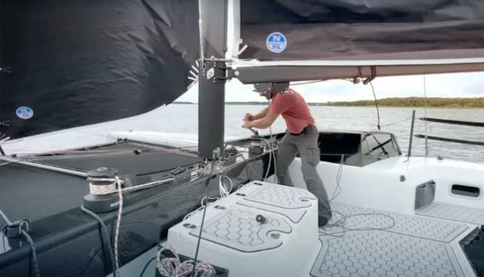
We sat down with Ryan Finn to hear about his journey: from his first encounter with competitive sailing to his remarkable voyage from New York to San Francisco around Cape Horn and his recent triumph in the Everglades Challenge, where finished in 1st place for class 5 trimaran and 4th place overall.
A Passion Ignited: The Beginning
A lifelong sailor, Ryan’s journey on the water began with family cruises along the Gulf Coast, but it was an interest for keel boat racing in high school that truly ignited his love for sailing. His passion for the sport was solidified in 1994, when he watched Isabelle Autissier compete in the BOC solo around-the-world race, setting the course for his sailing future. “I became fascinated by the technology and adventure of solo sailing. Seeing her glide across the finish 5 days ahead of the next boat in the first leg, and then her subsequent rescue in the southern ocean really ignited my imagination. I was hooked.“
Over the years, Ryan has sailed a variety of boats, each with its own adventures. “Which one?” he answered with a touch of humor when asked about his boat. One of his notable vessels is the trimaran used in the Everglades Challenge, a craft that reflects both his ingenuity and passion for the sport. The trimaran, based on an Adventure 24 main hull, includes lightened and lowered Nacra 5.2 hulls for amas, custom carbon beams, and a Hobie 18 mast/boom. Weighing at 394 lbs, this craft is “quite light for her length,” he shares.
The Everglades Challenge
Earlier this year, Ryan finished the Everglades Challenge in 1st place for class 5 trimaran.
Grueling and extreme, this race tests even the most seasoned sailors. For Ryan, the challenge wasn’t just in the sailing but also in navigating the course’s checkpoints. “If the EC was simply a sailing race, it wouldn’t be such a difficult challenge,” he explains. “However, getting in and out of the checkpoints, in my case with a compromised shallow water steering system, was very difficult.” At every checkpoint, his trampoline was covered with something: mud, sand, sea shells, or sweat and tears. Yet, he views the experience as invaluable, a necessary initiation that has prepared him for future challenges.
Ryan at the Everglades Challenge’s finish line
Racing with MAPTATTOO
We are proud to have MAPTATTOO as a part of Ryan’s racing toolkit.
“Waterproof with a 50-hour battery life, it was the system I used for 90% of my race and was the least finicky and most reliable source of info I had onboard. The black and white screen uses a similar technology to an e-reader and is easily seen in daylight. In fact I preferred using a headlamp to view it at night to the screen lighting feature, it was so clear. It’s the perfect device for races like the Race to Alaska and Everglades Challenge or just camping and cruising on small boats. It was easy to load and view my tracks onto a laptop for post race analysis. For ocean passages, I will keep it in my ditch bag, since it is so waterproof and holds its charge for so long. I’m excited to see how this technology develops as it is long overdue.”
Ryan arriving in San Francisco (Photo: Merfyn Owen)
Among the many races and passages Ryan has completed, one stands out as particularly memorable. “Easily, it’s the passage from Cape Horn to the latitude of Santiago, Chile, where I had escaped the Southern Ocean and its storms,” he shares. “It’s the only time on the whole trip that I was overcome with joy and laughed out loud for no apparent reason. The Chilean coast is quite intimidating when you’re trying to get away from it.”
This passage is a part of a daring solo voyage Ryan undertook, starting in New York and ending in San Francisco, with the route wrapping around both North and South American continents. “Route d’Or,” as this 13,225-mile course is called, is made significant by fabled Gold Rush-era clipper ships of 19th century. Ryan’s voyage carries a significance beyond its bygone days: he is the first in the world to solo sail Route d’Or in a proa.
Route Map (copyrights: Colligo Marine)
Staying Sharp on The Waters
Ryan on the Jzerro (Photo: Merfyn Owen)
Maintaining focus and resilience on the water, whether it’s amidst the turbulence of elements or long stretches of inactivity, is no easy feat. “It’s the hardest thing really. For the EC, I simply used the opportunities to get rest,” he says. His crossing from New York to San Francisco aboard the proa Jzerro was particularly challenging, with a grueling five days spent in the Pacific doldrums. “Any miles made good through the doldrums represent an enormous amount of energy compared to flying along in heavy conditions,” he notes. During such times, music and breathing exercises became his companions, helping him stay mentally sharp and focused.
Parting Words for Aspiring Racers
For those considering the Everglades Challenge or similar endeavors, Ryan’s advice is both practical and hard-earned. “For the Everglades Challenge, don’t overthink it if you haven’t done it,” he advises. “You will be wasting valuable time because there’s too much that you simply have to learn by experiencing the navigation in person. I’d say, make sure your boat is steerable in 6 inches of water and has an auxiliary propulsion system that allows easy maneuvering. Also, get as much rest as you can when you can. Any minute you can close your eyes without losing too much ground, take it.”
This is a part of our Explorer Feature series, telling stories of sailors, racers, and adventurers.
When you ask Mark Sperry how he discovered his love for sailing, his eyes light up as he reminisces about the adventures of his youth: “When I was a kid, my parents would take me on vacations to Lake Superior and the BVI”. These experiences, filled with excitement and wonder, laid the foundation for a passion to reignite later in life.
Living in Coastal Maine, Mark found himself in a moment of spontaneity during the pandemic. “Someone listed their O’Day Daysailer for a cheap price.”, he recalls. “I bought it on impulse, and pretty much from there, I became obsessed.”
Mark now sails a Tanzer 22, a slightly larger keel boat that allows for safer sailing in cold waters and do overnights. He has upgraded it extensively: “I replaced all the sails and running rigging, the electrical system, and 3D printed internal components for the cabin. I even built a DIY stern rail out of aluminum extrusions for my solar panels,” he explains. His most exciting addition is a Code-C asymmetrical cruising spinnaker, which makes the boat move efficiently in light air.
Sailing Highlights
One of Mark’s most memorable cruises was last year’s trip to Damariscove Island after weeks of fog and rain. An uninhabited, historic island six miles out to sea from Maine’s coast (Boothbay Harbor), this 210-acre plot is right in the open ocean and is accessible to boaters. “It has this amazing tiny harbor which was terrifying to enter as a solo sailor. If I missed grabbing the innermost mooring, I was definitely going to settle in the mud until high tide!”. Despite the challenge, everything went smoothly, and Mark enjoyed a perfect evening and hiking on shore.
This year’s sailing season has been favorable, with fair winds and frequent outings, despite a late start. “I’ve been averaging 1-2 days a week on the water,” he shares, looking forward to starting overnight trips in September.
Tech On Board: MAPTATTOO
Mark’s been navigating the cruises with MAPTATTOO marine GPS.
“I love that it’s a truly standalone tablet. It doesn’t need fancy connections to other boat systems, it just works! The battery life and daylight visibility are the most significant features that make it so great. I can mount it in the cockpit and have it tracking me all day, and easily see where I am, my speed, and if there are any shoals/rocks or something in my current course. When I was using my iPhone, you would be pulling it out of your pocket, watching the battery drain, losing focus on your environment. The MAPTATTOO is just there for at-a-glance situational awareness which is the most important thing in a place like Maine. Our underwater rocks are sneaky. Please don’t ask me how I know!”
Bon Voyage
As Mark continues to sail coastal Maine, his passion for sailing and DIY spirit inspire those around him. Whether it’s the thrill of a voyage or the satisfaction of a well-executed upgrade, his love for the craft is evident in every adventure he undertakes. For those new to sailing, Mark offers a practical tip with a touch of humor: “Lots of people new to sailing apparently don’t like it when the rub rail on the leeward side gets submerged. I can’t imagine why!”
Mark is also a photographer and documents his cruises. You can follow his journey on Instagram.
In the world of competitive sailing, where precision and teamwork are paramount, MM Sailing truly stands out. Founded by two F18 champions with rich backgrounds in boat design and competitive racing, the team has carved a name for itself on the global stage. But behind the spectacular performances lies a story of friendship, shared passion, and a commitment to excellence.
A Meeting of Minds and Masts
Matthieu, Manu, and their catamaran (peak MAPTATTOO on their mast)
Manu and Matthieu first crossed paths in the competitive circuit, racing against one another. Their mutual respect led to the formation of MM Sailing. From the outset, their collaboration was marked by commitment to excellence. “I had a lot to learn from this former F18 world champion,” recalls Matthieu. Over time, their professional relationship evolved into a friendship. “Most of what we do are just excuses to spend more time together because it’s a lot of fun,”.
The Cirrus F18 Catamaran
Cirrus F18 catamaran, the 901
Crafted in France and powered by Air Sails, their vessel of choice is the Cirrus F18 catamaran (the 901), designed by none other than Manu. “The Cirrus F18 can sail around 12 knots upwind and 18 knots downwind in 15 knots of wind,”. It’s designed for speed and agility, perfectly suited for the demanding conditions of races like the Worrell 1000—a grueling 1,000-mile race that tests both sailors and their equipment.
Worrell 1000: A Test of Endurance
Team MM Sailing during Worrell 1000.
This is not just any race; it’s a legendary test of endurance and skill. “This race is incredible. It’s the last existing race without assistance on a beach catamaran, exclusively using an F18 for the last two editions.” Matthieu reflects. “Being able to race for over 1,000 miles, sometimes at night, is very intense—especially over 13 days!”
The intensity of the Worrell 1000 is unmatched, and MM Sailing’s triumphant finish (3rd in the overall race) was not without its challenges. “The intensity means it’s tough when you make decisions that cause you to lose the gains you worked hours for in just a few seconds.”, Matthieu recalls. “At the finish of one leg we capsized just 15 meters before the finish line.” Despite this setback, MM Sailing finished in 2nd place for that leg, a testament to their tenacity and skill. “It’s an amazing sports and human adventure,” he reflects.
The Power of Routine and Technology
Races like the Worrell 1000 demand not only strength but also mental resilience. For MM Sailing, maintaining focus is key to staying competitive. “We try to stick to routines,” they say. “Watching the numbers change on our MAPTATTOO helps us stay focused and maintain efficiency. We also try to keep communication going as much as possible. And, of course, the marine wildlife is extraordinary to watch.”
One of the key tools in MM Sailing’s arsenal is the MAPTATTOO. ”MAPTATTOO has always been amazing, but I have to say the battery life and readability during both day and night have been ideal. There’s nothing more terrifying than losing your electronics at night when you’re sailing between sandbars and breakers.”, Matthieu shares. “I also have to say that MAPTATTOO isn’t just a tablet—it’s a team of people who love what they do and really care about their community.”
For sailors looking to tackle racing, MM Sailing offers practical advice: “Build a strong shore team and find the right partners to support your project! The hardest part isn’t sailing the event but putting the project together. Be ready for the unexpected… And when you’re on the water, enjoy every second because it’s a unique experience.”
“Make sure you’re prepared to spend a lot of time with your crew and that you can trust them—especially if you fall in the water, knowing they’ll do everything possible to get you back on the boat.” And when it comes to equipment, they emphasize the importance of reliability: “Our Cirrus catamaran had no issues, and the same goes for our electronics from MAPTATTOO, our sailing gear from Soöruz, and our sails from Air Sails.”
Looking Ahead: The Dream Continues
Team MM Sailing celebrate a close finish at Virginia Beach in the Worrell 1000 Race
When asked about the most memorable races of their career, MM Sailing is hard-pressed to choose just one. “So many of them! Of course, every time you win a race or make it to the podium, it stays in your memory.”, Matthieu reflects. But beyond the victories, it’s the simple act of being on the water that fuels their passion. “Any time spent on the water is memorable because it’s my passion,” he shares.
As for the future, MM Sailing has their sights set high. “We’re living the dream! We want to stay competitive and be on the podiums as much as possible,” they affirm. With their proven track record and unwavering dedication, this is the team to watch.
New Orleans, Louisiana – March 26th, 2024 – Years before I even conceived of doing NY to SF on a proa, I wanted to do the Everglades Challenge. I’ve thought of many different boats for the challenge and thought it would be a good idea to do it as crew or on something more conventional first to get a lay of the course. Ultimately, I ended up with a conservative, albeit very lightweight trimaran for the event and was actually very happy with the choice.
Now, for anyone who has been watching this event with envy or trepidation for years, I want to demystify some things for you here based on my one-time experience.
This is not a sailboat race. It’s harder. You don’t need the fastest boat to do well in this event. This is a race between checkpoints, the checkpoints being where the real gains and losses happen. You must have a boat that rows, paddles, or peddles easily if you want to be competitive overall. (My boat didn’t really paddle very quickly with a lot of wetted surface area and windage, and controlling the heading while changing course singlehanded was very difficult. I’m not sure what I’ll do about this for next year.)
You MUST be able to sail in 6 inches of water. There are long stretches, especially at checkpoints 2 and 3 where there is very little water. If you cannot kickup your rudder ala Hobie Cat AND still steer the boat, you will be really limping through these stages. (I had a kickup rudder on the main hull which drew 2’3” and the kickup part failed immediately after the start, requiring me to go into the water and reconnect the rudder every time the water was deep enough. This occurred about 8 times during the trip. In my case I couldn’t steer with the rudder kicked up, so I made a shallow draft rudder for the starboard ama to help, but it didn’t offer nearly the amount of control necessary for this course and I often had to take the mainsail down or depower it to keep the boat under control, while dragging the main rudder behind the boat by its steering cables until I was in deep enough water to reconnect it. No way will I be doing it this way next year.)
The charts for Stump Pass, coming into CP1 are not helpful. This is a local knowledge situation and with current flowing in either direction, it can become very difficult. Charts for the rest of the checkpoints are also a grain of salt situation. Nothing beats going out there and seeing them all in person.
If you don’t have time to survey the course prior to the race, just do like I did and survey it by grounding your entire way through and sign up for the following years event
Tribe names: to find out about the race you must register an account on www.watertribe.com. At the top banner you will see something called “discussion” which means forum. There you must also register to post. HOWEVER, the name you sign up with cannot be your real name and whatever you put down will be your tribe name FOREVER. I heard several times participants who were like “why did you pick that name” and they were just like “I needed something to sign up with and I didn’t realize it’s permanent.” It is. So choose wisely. It doesn’t matter what you name your boat, they will track you by your tribe name, so you might as well name the boat the same thing or visa versa. It’s nice and confusing for your family members who are following the race looking for your boat name or your name only to discover later they were following the wrong boat ,etc… This is simply the way it is and that’s that.
The start:
At the start I was a little slow off the beach and when trying to lower the kickup rudder system (my design), despite having tested it for many miles prior to the EC, it immediately broke off. Oh well. So, I hopped into Tampa Bay, reconnected it with its retaining line and started heading on a close reach to exit the Bay at Anna Maria Island. After deploying my Code Zero I quickly sailed through the fleet and had a comfortable lead by the time I was at Anna Maria. I was hoping to not be leading there because the charts for the area don’t really show what’s happening and I wanted to follow a more experienced boat. I conservatively went offshore to clear the shoals before heading back on course. The boat Spawn was the next boat out of the bay, and they cut a corner I knew was there in research but didn’t have the confidence to test considering my rudder situation. From there it became a very light wind beat to Stump Pass. For the first part of the morning, I stayed offshore, tacking in to cover the boats nearest. By mid-day I split and went offshore, while the crewed boats short tacked near shore all day, likely dodging more North flowing current than me, but it felt more stable offshore. By the afternoon it was clear that I had lost a lot of ground to Spawn and started seeing more boats behind me. However, it still felt bad inshore and was shifty, so I went back offshore making a very favored tack to Stump Pass late that evening and taking the lead again. Pitch black at Stump Pass, I tried using the charts I had to negotiate it, but the light wind and current flowing out really became confusing and I was swept onto a shoal quickly once close to the entrance. I spent the next hour or so running aground, letting the rudder pop off and being pushed back into the Gulf by the current. Then jumping in to reconnect the rudder and trying to sail in, only to have the same thing happen again. I tried pulling the boat against the current off a shoal, but that quickly became dangerous. During this time, I watched Spawn, the Inter 20 (Bump and Tern) and Hobie 16’ (Tenzan and Midnight Crew) pass me in that order. I had no idea how they got through at the time and ultimately used my anchor to kedge into the channel, then reconnected the rudder and paddle to CP 1. I took my time there cleaning the piles of sand and seashells off my boat, fixing some sail furling problems and borrowed a new SPOT from (Mr. Moon) who lent me his Spot device after mine had completely stopped working due to all my swimming activities. He later told me that the SPOT doesn’t have to be attached to my life jacket, which I was unsure of from inspections.
Leg 2.
No wind on departure, at least within the intracoastal waterway leading to Gasparilla Pass. I paddle for a while, then decide to simply drift down the canal and take some naps until some wind arrives. Several additional boats pass me here, but I’m not very concerned about that. Due to my rudder handicap I’ve resigned myself to using this race as a survey of the course. Around sunrise, a little wind fills in and I start sailing again, following Apeman and Janseaka on a Nacra 5.7 catamaran through the channels to Gasparilla Pass. They pull up onto the beach at Port Boca Grande and I continue over the shoals with my rudder down, hoping I skirt over them without problems. I make it into the channel gybe several times and I’m back into the Gulf and alone. I spend the rest of the day sailing upwind in very light wind, with a nice fat tack offshore before coming back to the south side of Sanibel Island, near Fort Myers. There the wind dies completely. I decided I can paddle for an hour and go one mile or get some sleep. I usually chose sleep. I wake up after sunset to a slight east wind, unroll the Code Zero and start reaching quickly toward Marco Island, roughly 30 miles away. Soon I have the Code Zero down and am jib reaching at 11 to 15 knots directly on course in flat water. It’s the best sailing I have during the whole race and I’m very quickly south of Marco Island and tacking through Cape Romano Shoals on the approach to CP 2. By sunrise I’m in Indian Key Pass and short tacking like a maniac with an incoming tide and some very narrow channels. I get stuck a couple of times, but there’s enough wind to sail, so I refuse to paddle. I see Tanzen and Midnight Crew coming up behind me, clearly motivated and paddling. They tell me later that I passed them on the beat to Indian Key Pass. As I’m getting into Chokoloskee Bay I see Bump and Tern leaving the checkpoint, so I’m still in this race to some extent. At least I don’t have a boat speed issue while sailing. On port tack across the bay, my main rudder whacks the bottom and I stop. I let the rudder break away again and drag it to the checkpoint with the little rudder doing whatever it can to keep me on course. There Tanzen and Midnight crew pop in right behind me and have a pretty quick turnaround, me a bit behind them.
Leg 3. It’s downwind leaving CP 2, in very light wind, and I take the mainsail down to keep my little rudder working without weather helm. Instead, I sail out with a jib only then the Code 5, through Everglades National Forest and it is beautiful. I hear wild birds and see sea turtles all the way to Demijohn Key. There I jump back into the water and reconnect the rudder. For newbies like me, the bottom here is all oysters, no sand. Now the wind is extremely light. I paddle to build apparent wind for the sails to work and see Tanzen and Midnight Crew well on the horizon to my south. I take a nap in the hot sun and wake up to a slight north westerly wind, which is not expected, but welcome. Now I can sail again and unroll the Code 5, sailing fast with what wind I have, and I start making gains on Tanzen/Midnight Crew. Soon they are well to my west and by the afternoon, off my aft starboard quarter with a spinnaker up. I’m happy with my boat speed, but I know they are sailing the hell out of that Hobie 16. I couldn’t believe how fast they had been through the whole race. By night fall, I’m beating into a strong east wind around Cape Sable and having some problems with my tiller, the bolt holding it down having to constantly be retightened. This is annoying because the autopilot rudder reference unit must be unbolted for access to the tiller bolt and by the end of the race, I had a quick release method in place with zip ties and one bolt. It got quite bad. I reefed the mainsail and sort of limped into the channel for checkpoint 3 at Flamingo Key. This was the worst checkpoint for me, and I spent hours in waist dep mud trying to drag the boat into the channel only to realize there really isn’t a channel, just markers. Forget your charts here. It’s awful. I then paddled very slowly into the checkpoint having already been passed again by the Hobie 16. I wasn’t too bothered since myself, the boat and sails were covered entirely with mud and aggravation. Wet inside my gear with sweat and saltwater I finally made it into the marina where I demanded a hose to clean the boat like a little princess. The folks there had done the race and were very tolerant of my wet cat behavior. They told me that nobody was close to me, so it would be a good idea to rest there and honestly, I was feeling a little hypothermic, so I wore my wet gear under a tarp and fell asleep with an alarm set for half an hour. Half an hour later they convinced me to stay until sunrise and I did it happily, wanting to see the last part of the race in daylight for next year. I probably slept for 5 or 6 hours and felt great! I left at sunrise and paddled out with my rudder dragging behind me again, reconnecting it off Murray Key, then sailing the long way around heading due West into the yacht channel. This is the only time I used my spinnaker for anything other than a pillow during the whole event. Very choppy upwind conditions after making my turn and it quickly became flat water sailing again with good pressure. I had to do some short tacks through Bowlegys and Steamboat Channels but was able to sail directly through the rest on starboard tack almost all the way to the finish. Perfect and easy sailing really, often making 10-12 knots and comfortable. Once through the last channel, Baker’s Cut, I began looking for the finish beyond the anchorage off Sunset Cove, Key Largo. Easy to spot with all the hands waving from shore and I made one tack in the large wind shadow of Key Largo and paddle-sailed to the beach for my finish. There were kids yelling and people clapping, me standing on the port ama like a dazed fool, boatlenghts from the beach. Then there was a huge bang beneath me and an explosion of water all over the place. Shocked and confused af first I assumed the boat decided to explode at the finish then told myself it was a manatee, however the people on the beach told me it looked more like a very large fish. I assume a tarpon or shark. Either way, no damage and I finished the race at sunset, and it was beautiful. I was the 4th boat to finish and first single-hander by over 31 hours, so pretty content for a first shot at this course.
These types of events start off as races when you sign up. By you finish you realize they’re about surrounding yourself with a community of freaks willing to do these kinds of things and having a good laugh about it after it’s over. A tribe of nuts. In the end, the community is the reason the Everglades Challenge is still going on and the reason I will be coming back next year.
Thank you to the event organizers, participants and my sponsors.
#sailsforsustenance: SFS repurpose used sails for the fishermen in Haiti who use sailing craft to go well into the ocean to provide for their families. Please contact me if you have sails to donate to this cause. As hard as the Everglades Challenge seemed,it’s absolutely nothing compared to the challenges faced by these families.
#ColligoMarine : They provided all of the standing rigging for my boat in this event. Having used their rigging to sail around Cape Horn on Jzerro, I knew there was only on company I had complete trust in for this race.
#Maptattoo : their navigation tablet, designed specifically for races such as the Everglades Challenge and Race to Alaska worked perfectly. The unit is waterproof, holds its charge for 50 hours and has a screen that is easily viewable in broad daylight. Maptattoo was 90% of my navigation during this event and the only thing powered on when I finished.
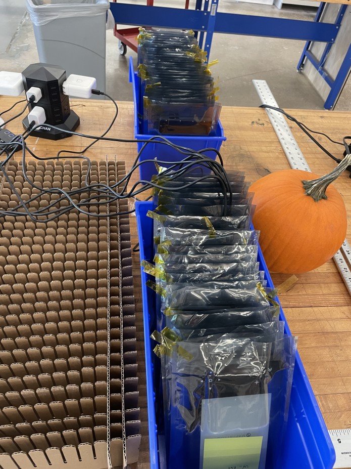
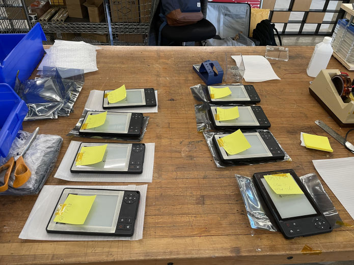
Chicago, Illinois– October 31st, 2023 – We shipped 16 units yesterday and 22 more today.
We should be able to ship all the Indiegogo pre-orders by friday.
While you are waiting for your unit, you can familiarize yourself with our user guide.
You all should have an account for our website which allows you to download chart updates and log tickets. You can use the email you informed on your contribution and click the link for forgotten password to reset it.
This is a new product, bugs are likely to occur. Please do your best to log them and give us as much information as possible and we will provide fixes as soon as possible.
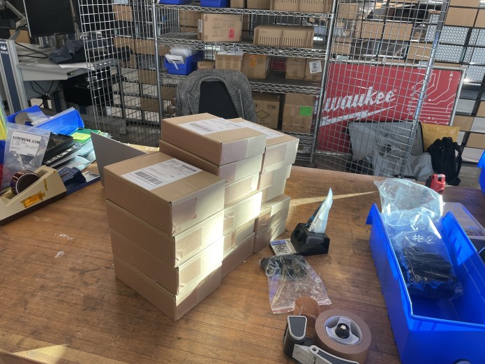
Los Gatos, California– October 30th, 2023 – A number of you have received a tracking number 9 days ago. This was just us printing labels and our shipping partner sending notification emails.
We have not shipped yet but are expecting to ship our first batch tomorrow.
We are hoping to ship to all our backers this week.
You will receive an order confirmation email which will be the indication that your device has been assembled and assigned to you. This also means that you will be part of the next shipping batch.
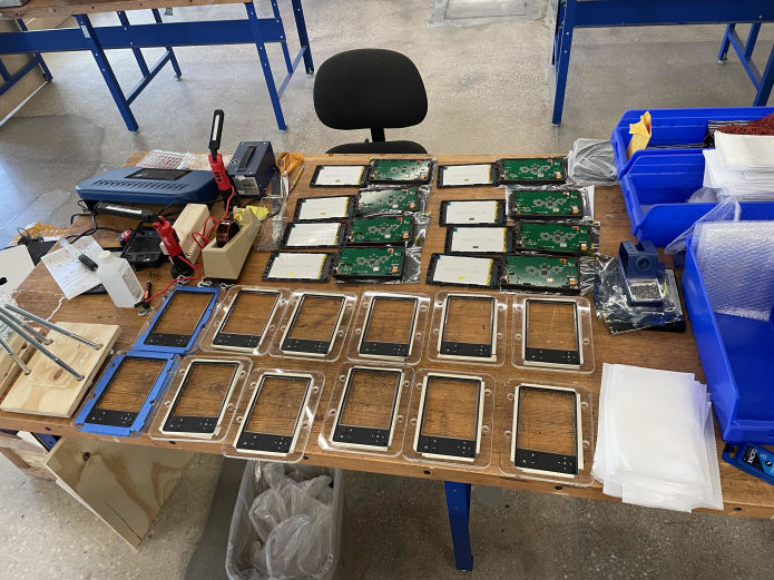
Los Gatos, California– October 17th, 2023 – Hello Backers!
We have received almost all our components except our screens which are scheduled to arrive in our assembly facility early next week. We will then start our final assembly mid next week which should still allow us to start shipping in the next 2 weeks. We have finalized our plan for the final assembly and feel good about it. It is going to be a busy next 2 weeks…
In the meantime, I encourage you to make sure your shipping address is up to date:
Login to Indiegogo
Click on your name on the upper-right hand corner of the page
Click on ‘My Contributions’
Find the perk you’d like to change your address on and click on ‘View Details’
Click on the ‘Edit Shipping Address’ button on the left side of the contribution,
Complete the changes you need to make to the address, and be sure to click ‘Save’
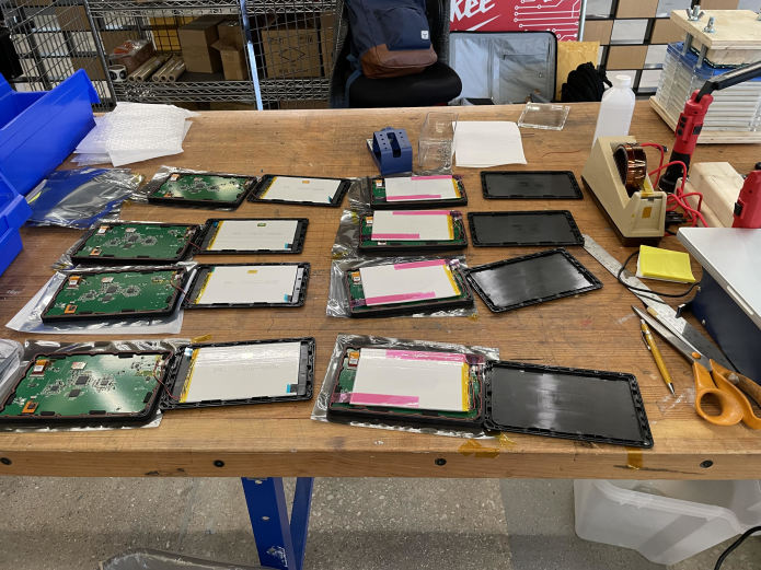
Los Gatos, California– September 25th, 2023 – The printed circuit board is the brain of MAPTATTOO. This is where the magic hapen and its design is the reason we are able to get exceptional performance.
Here is a video of our production batch. 150 Printed Circuit boards are being assembled, which covers our needs for this Indiegogo campaign.