N2K / NMEA 2000 Integration (with Gateway)
Need N2K / NMEA 2000 connectivity? Get a bundle with Bluetooth Gateway and save $99. Together with the Gateway, MAPTATTOO Pro can display N2K / NMEA 2000 data, such as:
- Navigation & Position Data
- Wind Data
- Environmental Data (Air and Water Temperature)
- Navigation & Routing
- Time & Date
- Trip Statistics
- Calculated Values
- More to come
Calypso Wind
Small and robust, get instant wind speed and direction….or track it!. Built with ULTRASONIC sensors, with no moving parts to make it robust and dependable, the Ultrasonic Portable is a wind meter that measures both speed and direction, allowing data logging via a free app. Thanks to its small size and light weight, the Ultrasonic Portable wind meter can be used both as a handheld and/or as a stand-alone wind meter what makes it a versatile instrument of great value on a wide range of industries and applications.
Order directly from https://www.calypso.com
And connect to your MAPTATTOO PRO in seconds
AIS integration (with Gateway)
For AIS integration connectivity, please get a bundle with Bluetooth Gateway and save $99. Together with the Gateway, MAPTATTOO Pro can track nearby vessels with integrated AIS, presented clearly. Stay aware of traffic around you and navigate with greater confidence in crowded or changing conditions.
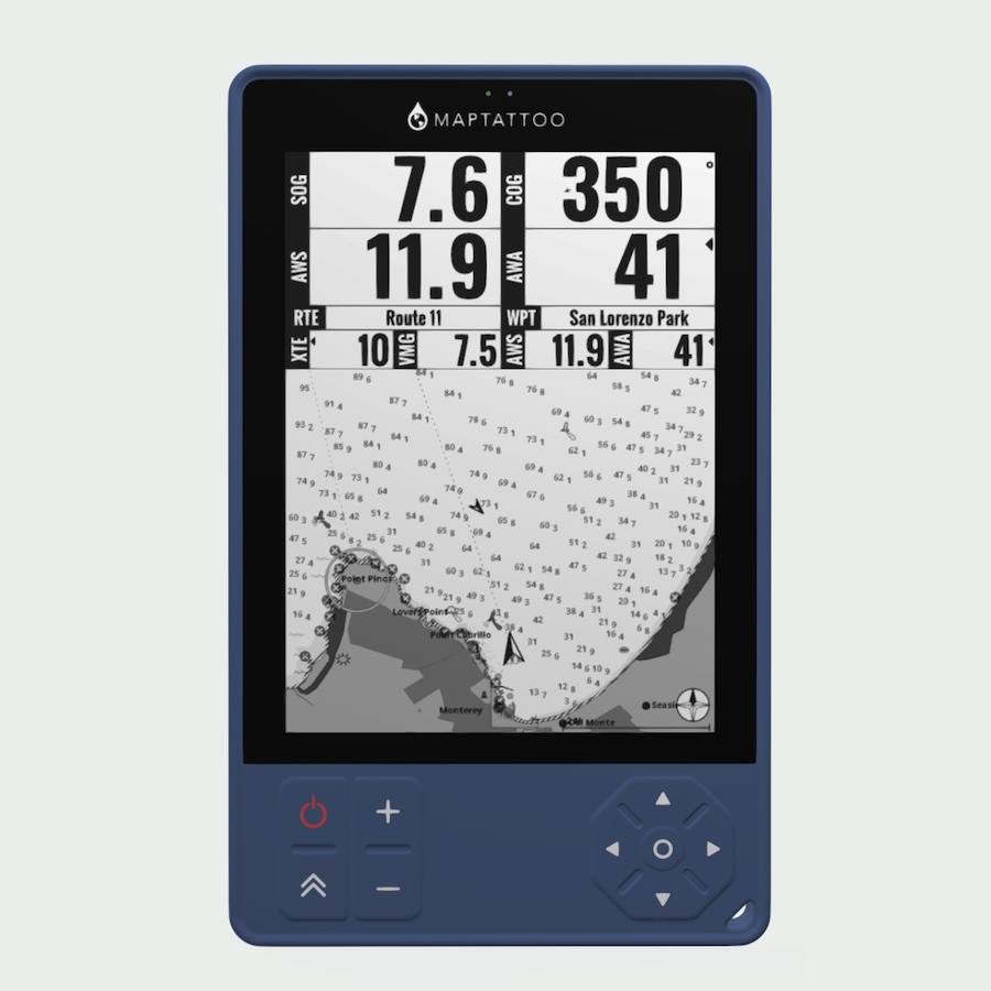
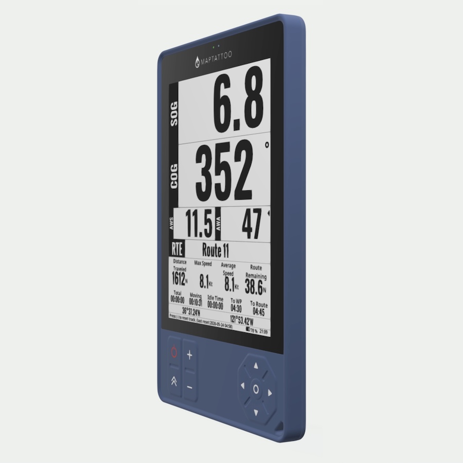
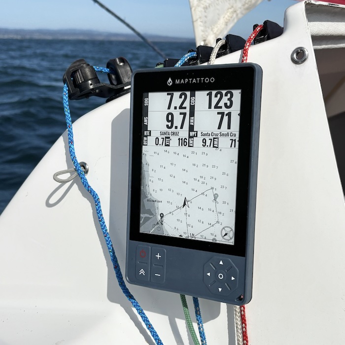
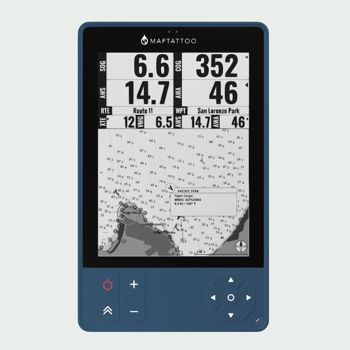
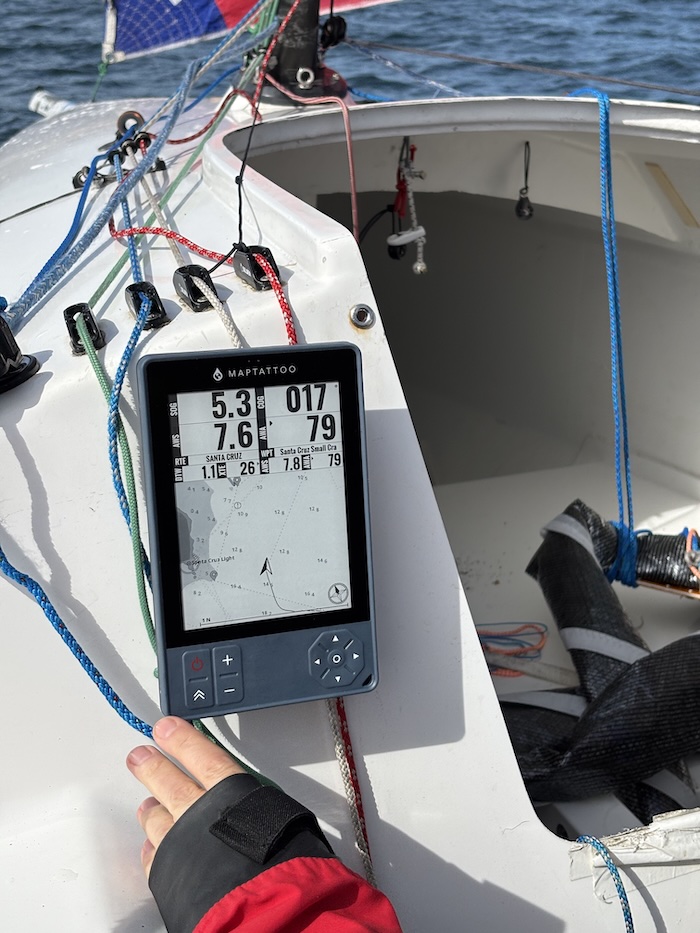
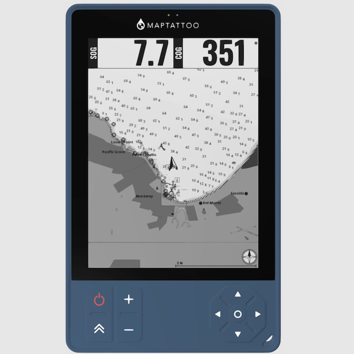
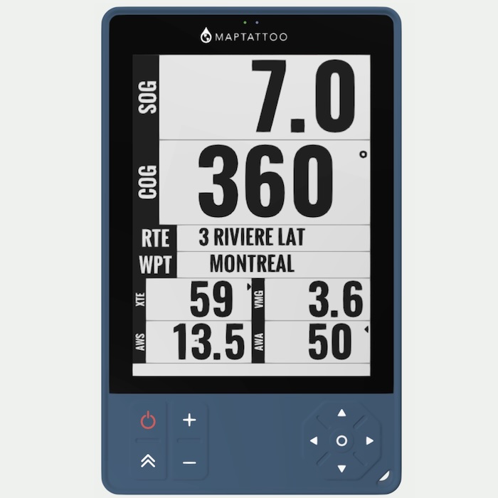
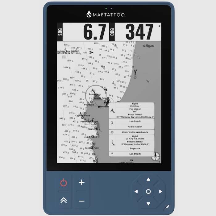
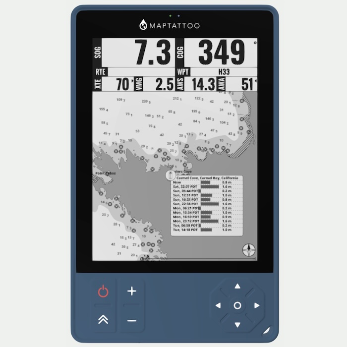
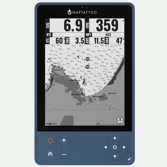
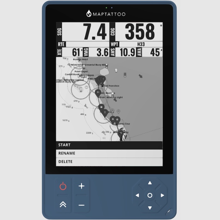
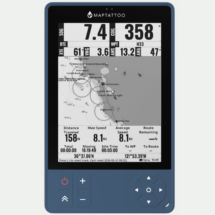
Chartplotter Functions
- Speed over ground
- Heading over ground
- Distance, bearing to waypoint
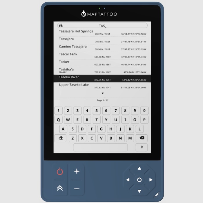
- Routing capabilities
- Chart plotting
- Tides & Current for USA & Canada
- Configurable Pages and Widgets
- (soon) many more functions to come, free software updates available
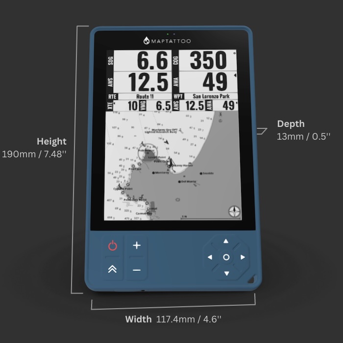
Large Screen, Perfect Readability
- Large 6” E-Ink Screen
- High viewing angle
- 1448*1024 pixel resolution, 300 PPI
- 16-level of grays
- Adaptive front light
- Optically bonded 1.1mm Gorilla Glass, rugged construction
- Anti-reflective coating
Optimized Power, Long-lasting Battery Life
- 5000mAh Battery
- 50-hour long-lasting battery life (with constant refreshes)
- Always-on display
- Power-save mode available
- Waterproof USB-C fast charging
- Chartplotter battery can be replaced
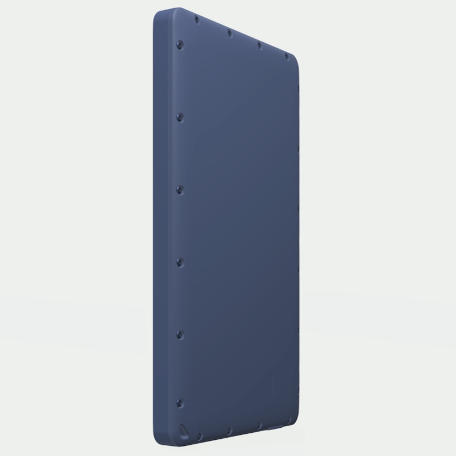
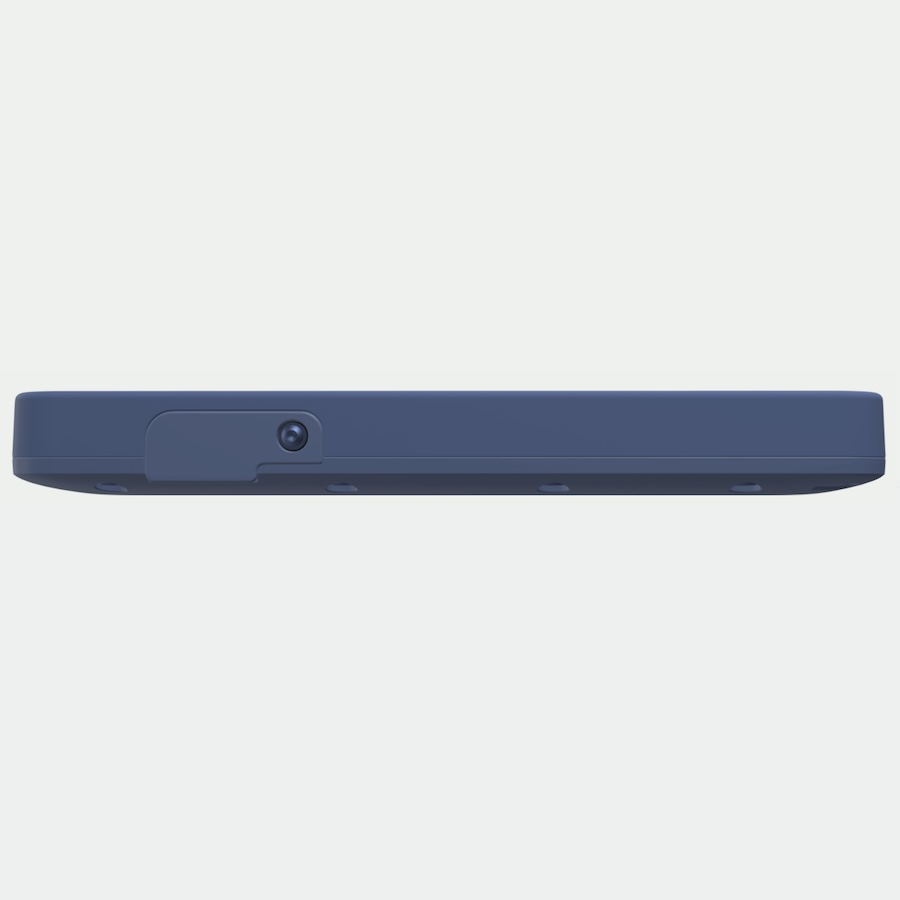
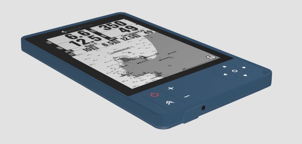
Rugged & Waterproof
- IP68 waterproof (30 minutes, 1.5m/5′)
- The rugged tablet is made with a tough shell and overmolded with elastomer for shock resistance
- Sealed USB-C Cable allows to plug and charge in wet environment
- Keypad allows access to most functions when touchscreen becomes hard to use when very wet
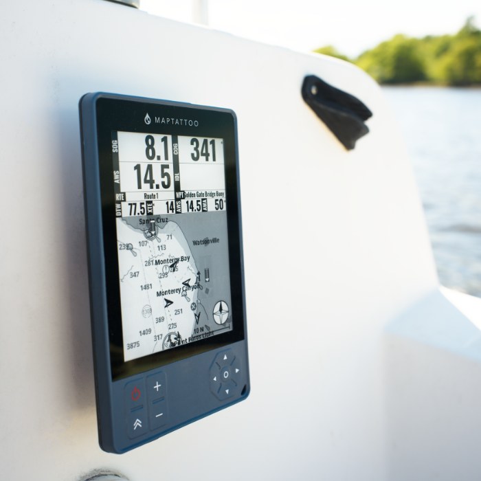

No Installation Needed
- Portable boat GPS, designed with small craft in mind
- No electrical installation – no need to install it into your boat system, simply take it to the small craft you are using, be it a boat, kayak, paddleboard, dinghy, canoe, or more
- Mounting options available
Chartplotter Tech Specs
SYSTEM
- 1GHz, Arm® Cortex®-A9 processor
- 512 MB LPDDR3 RAM
- Linux OS
- Firmware and Software. Upgrades available for customers
- 32GB NAND Storage (plenty for charts and logs storage)
GPS
- 72-Channels
- GPS/QZSS L1 C/A, GLONASS L10F BeiDou B1I, Galileo E1B/C1 SBAS L1
- up to 18Hz
- Ceramic GPS/GLONASS/Galileo embedded passive patch antenna
- 3.23dBi gain
CONNECTIVITY
- USB-C Connectivity
- Bluetooth Connectivity
- Connects to Mac OS, Windows, Linux
- Upload and Download charts packages, log files, routes and waypoints
- Upload and update firmware and software
- Settings updated from your computer

Available Charts: USA, Canada & France
USA Pacific | USA Atlantic | USA Great Lakes | Canada Pacific | Canada Atlantic Canada Great Lakes | Canada Arctic | France
Coming soon: US Inland Lakes, Canada Inland Lakes, UK, Ireland
FAQ
FAQ
Do I need to buy charts separately?
A set of charts is included with the purchase of your MAPTATTOO, simply select the area you are interested in at checkout. You can buy additional charts here: https://www.maptattoo.com/charts/
What mount options do you have?
- You can purchase our Quadlock kit: https://www.maptattoo.com/product/quad-lock-mount-kit/
- You can order a kit directly from Quadlock (they have more mount options): https://www.quadlockcase.com/collections/build-your-own?selected=eyJoZWFkIjoiUUxQLTM2MC1MSCIsImJhc2UiOiJRTFAtMzYwLUZBQiJ9 - you will need to include a "Universal Adapter" that can be glued to the back of MAPTATTOO
- We also have many customers who just use 3M Dual Lock tape
Where can I see more functions?
You can see a detailed breakdown of our marine GPS here
Is the screen colored?
The E-ink screen is black & white (grey levels), but what we lose with monochrome is compensated by an extraordinary contrast in sunlight. Additionally, our screen consumes minimal power, allowing the battery to last for 50 hours.
Can it use external power and can the internal battery be replaced?
The device can be plugged via waterproof USB-C to an external power supply, and the internal battery can be replaced at our facility in Chicago.
How can I contact support?
You can email us at support@maptattoo.com or fill out this form: https://www.maptattoo.com/contact-us/
Steve Katz –
Great unit! Easy to set up, easy to mount. Intuitive functionality. Very happy with my MAPTATTOO Pro. Charts are excellent. Great to have a chartplotter where I want it without cutting holes or running wires!
Bob T. –
This is a composite review. I had the opportunity to use the Classic MAPTATTOO tablet my delivery skipper had when my boat was moved. I’ve subsequently purchased my own PRO version and I am learning its functions and looking forward to using it. I’m new to the world of electronic navigation and the tablet’s function and features are mind blowing for me. One stop shopping for so much data in an incredibly handy package.